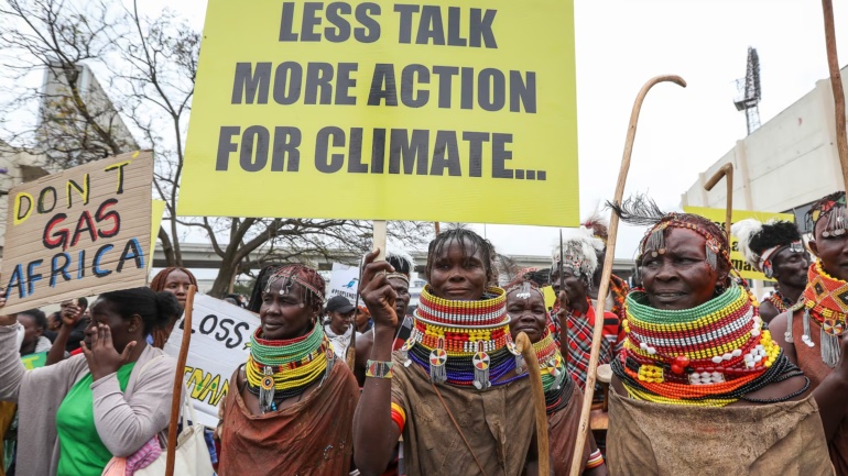
For months, the rains simply have not come despite the prediction of a potential super El Niño. Across Djibouti, Eritrea, Ethiopia, Somalia, South Sudan, and Sudan, farmers have watched their fields dry out while pastoralists have herded livestock across increasingly barren rangeland.
Now, climate scientists warn that parts of the same region could swing in the opposite direction later in the year, toward a wetter season that could trigger floods, disease outbreaks, and displacement.
What the Forecast Maps Reveal
Strip away the technical language, and ICPAC’s advisory is really a set of maps telling the story of a region drying from the inside out.
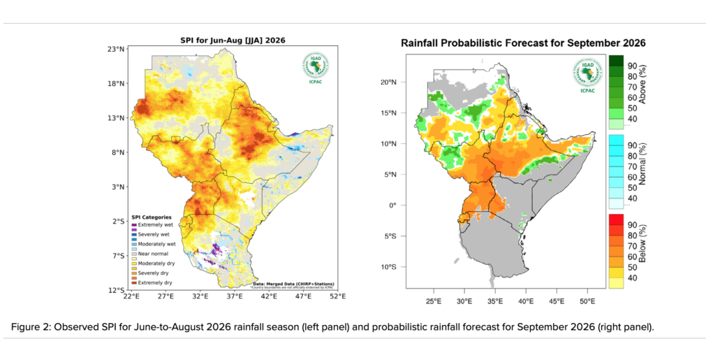
A rainfall map covering June through August, measured using the Standardised Precipitation Index that compares actual rainfall against historical norms, is washed in orange and red across a broad swath of Sudan, stretching down through South Sudan and into parts of Ethiopia, Uganda, and western Kenya. Those colours indicate severely and extremely dry conditions, not just a below-average season.
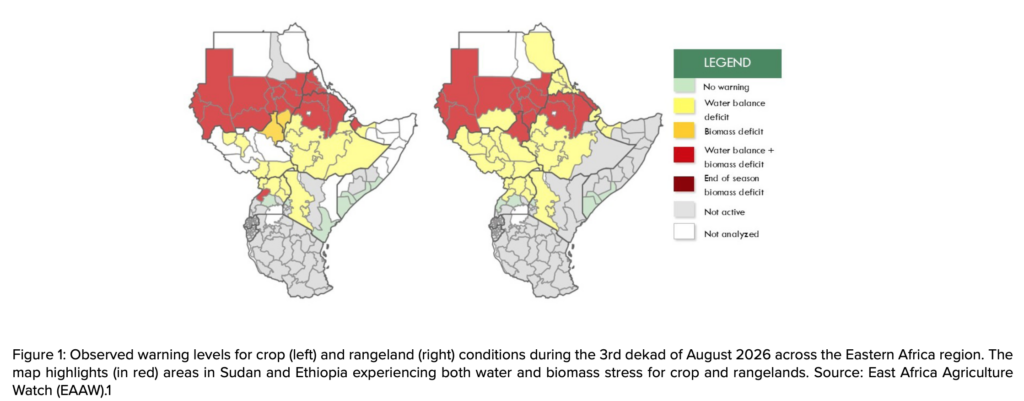
A second pair of maps, tracking crop and rangeland conditions, reveals the consequences of those missing rains. Across much of the region, monitoring products indicate soil moisture deficits, vegetation stress, or both.
In parts of Sudan and Ethiopia, the maps highlight areas experiencing both water and biomass stress in crops and rangelands. This overlap highlights areas where both water availability and vegetation conditions are under severe pressure, contributing to elevated alert levels, particularly in Sudan, northern Ethiopia, and parts of Eritrea.
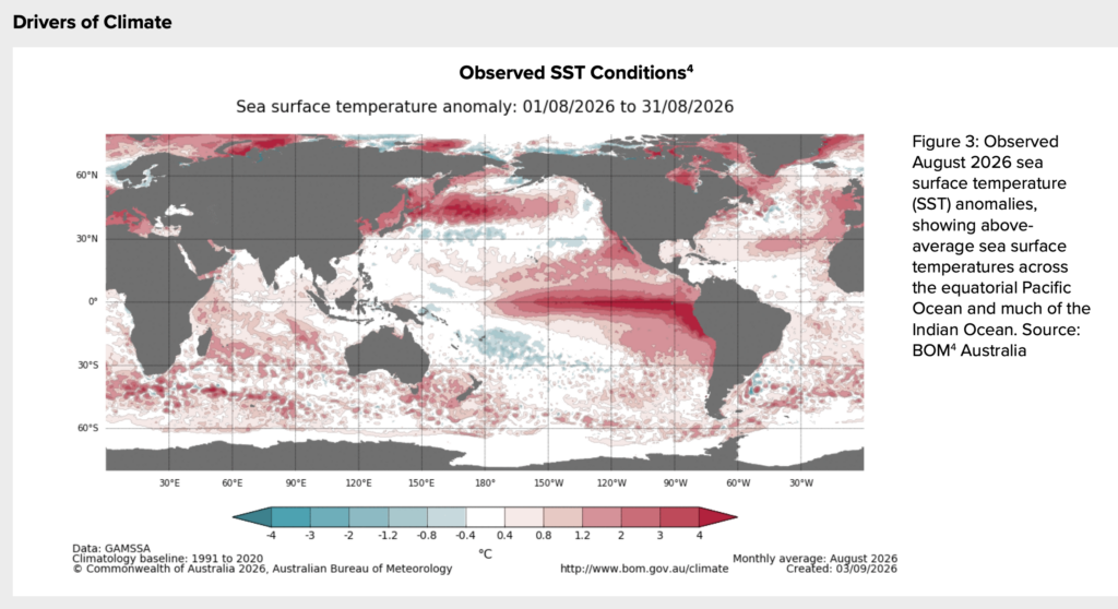
Zooming out to a map of the world’s oceans reveals part of the climate signal behind the forecast. A sea-surface temperature chart for August shows above-average sea-surface temperatures across the equatorial Pacific Ocean and much of the Indian Ocean, which are conditions associated with a strengthening El Niño signal and a developing positive Indian Ocean Dipole (IOD).
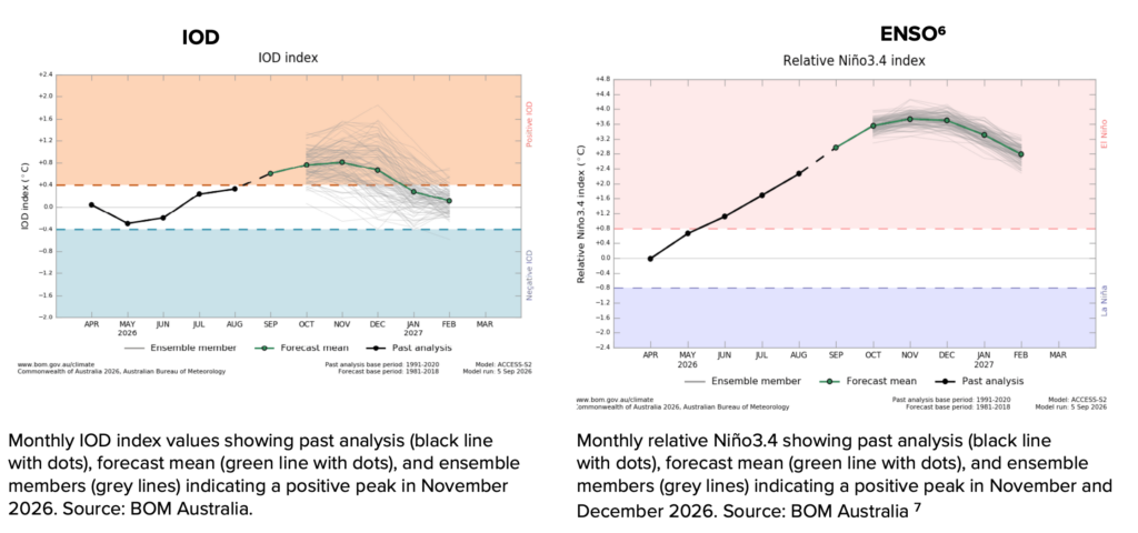
The two climate drivers are not at the same stage. ICPAC notes that positive ENSO conditions continue to strengthen, while the Indian Ocean Dipole has remained neutral but is trending toward its positive phase.
Forecasts indicate that El Niño conditions are likely to strengthen further, with a greater than 90% probability of persisting through the March–May 2027 season. The positive IOD phase is expected to emerge in September and persist until December.
Forecast charts show the Niño3.4 index reaching a positive peak around November and December, while the IOD is projected to peak around November before easing.
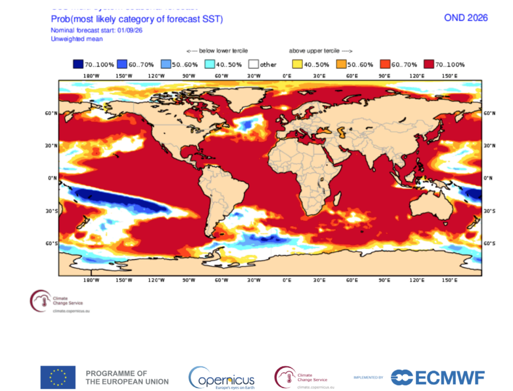
A separate global projection for October through December shows a greater than 70% probability of above-normal sea-surface temperatures across the world’s oceans. The map places the regional forecast within a much broader pattern of elevated ocean temperatures, although the impacts on rainfall vary by region and season.
The influence of these ocean and atmospheric conditions helps explain the rainfall outlook for the northern sector. Historically, ICPAC notes, El Niño has been associated with suppressed rainfall over the northern sector of Eastern Africa. Its continued development therefore increases the likelihood that below-normal rainfall conditions will persist in areas already experiencing deficits.
ICPAC’s probabilistic rainfall forecast for September shows an increased likelihood of below-normal rainfall across Sudan, western Eritrea, Ethiopia, western Kenya, South Sudan, and Uganda.
Combined with the ongoing development of El Niño, those deficits are likely to worsen already deteriorating conditions in the northern parts of the region, with severe implications for agriculture, food security, water resources, livestock production, public health, and livelihoods.
However, the climate reversal will not occur uniformly across the Horn. While parts of the drought-affected northern sector are forecast to remain dry in September, the October–December outlook points to wetter-than-normal conditions farther south and east, including southern Ethiopia, central and southern Somalia, and north-eastern Kenya.
From Early Warning to Early Action
IGAD’s high-level declaration picks up where the forecast leaves off. It notes the potential for wetter-than-normal conditions during the October–December season, with the highest chances of heavy rain concentrated over southern Ethiopia, central and southern Somalia, and north-eastern Kenya.
That rapid transition, moving from months of drought in some areas to the possibility of intense rainfall elsewhere, is what has officials deeply concerned. Communities that have spent months rationing water and moving livestock in search of pasture could suddenly face flash floods, landslides, and displacement.
Rapid swings between extremes also create secondary risks. Flooding after prolonged drought can concentrate livestock around limited dry ground and grazing areas, accelerating the spread of disease and heightening competition over shrinking resources, all while pastoral communities are still trying to recover from the dry months that preceded it.
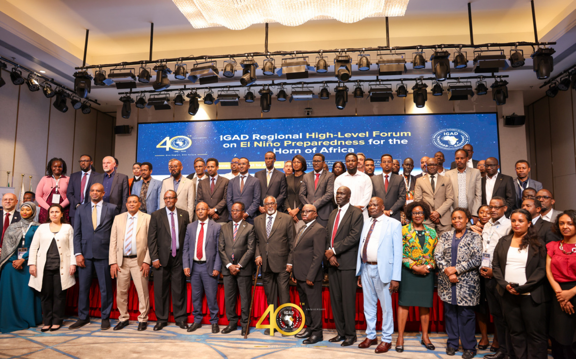
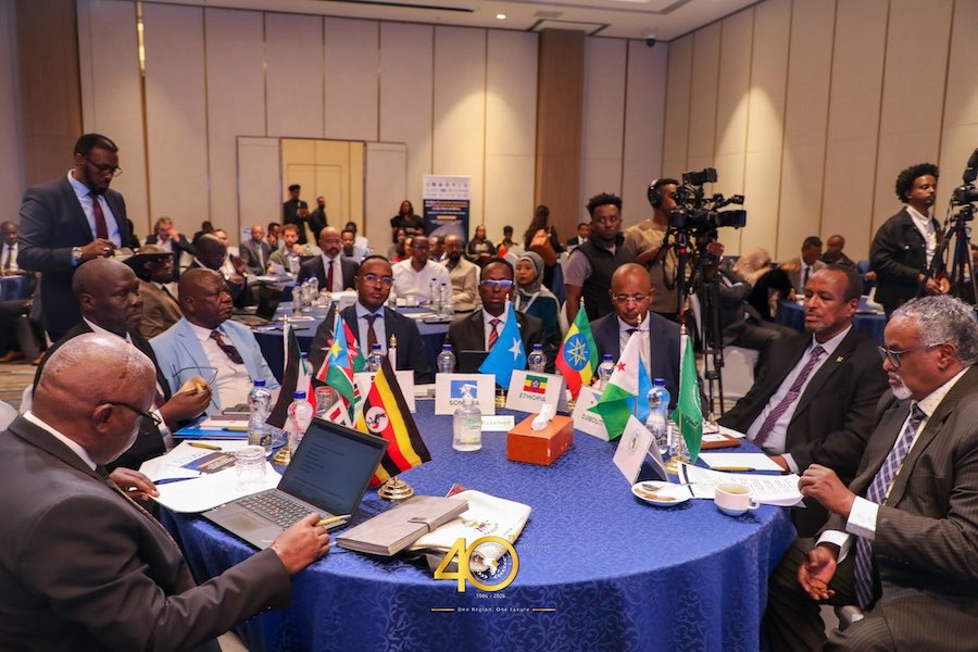
What sets this moment apart from past climate emergencies in the region is the timing of the response. Rather than waiting for floods to arrive, ministers, commissioners, and heads of delegation from IGAD member states gathered in Addis Ababa to commit to acting before the rains peak, citing evidence that every dollar spent on early, anticipatory action can save up to seven dollars in disaster losses later.
Their joint declaration lays out a clear list of commitments: reviewing and activating emergency plans before the October rains begin, pre-positioning food and medical supplies in high-risk areas, vaccinating livestock ahead of flooding, and strengthening health systems to detect water-borne and vector-borne diseases such as cholera and Rift Valley fever early.
Beyond national governments, the declaration calls on donors and financial institutions to release funding based on pre-agreed triggers rather than waiting for a crisis to unfold. It also asks the media and local communities to help disseminate official warnings and counter misinformation as the season progresses.
The declaration is blunt about the stakes of timing: the window to prepare before the October–December rains arrive is now a matter of weeks. ICPAC’s climate watch is expected to be updated on or before October 16, a critical checkpoint that will show whether conditions in the drought-affected north are easing, deepening, or shifting as the wider rainfall season progresses.
For a region still recovering from prolonged dry conditions, the coming months will test whether early warnings, mapped, forecast, and now formally acted upon, can translate into effective early action before the rains arrive in full force.