The Greater Horn of Africa is heading into a potentially wetter-than-normal October–December (OND) season, with climate scientists warning that a combination of a strengthening El Niño and a positive Indian Ocean Dipole could bring enhanced rainfall across large parts of the region.
Held under the theme “Harnessing Climate Services for Early Action and Resilience in the Greater Horn of Africa in the Face of a Strong El Niño,” the forum brought together climate scientists, government officials, humanitarian agencies and development partners to translate the latest forecast into decisions across sectors.
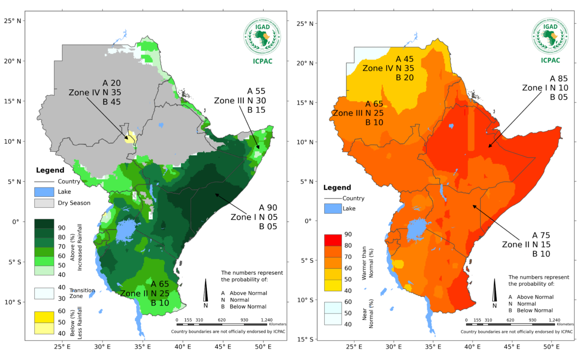
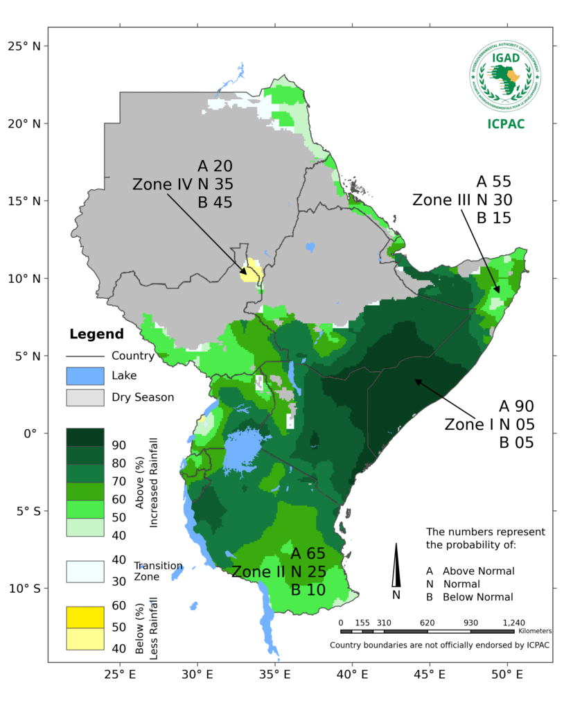
The regional outlook by the IGAD Climate Prediction and Applications Centre (ICPAC), developed with National Meteorological and Hydrological Services across the Greater Horn, points to an increased likelihood of above-normal rainfall across much of the eastern, equatorial and southern parts of the region.
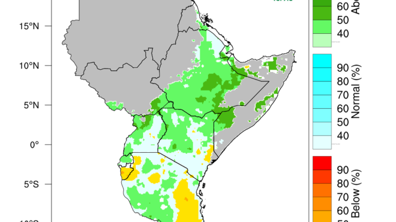
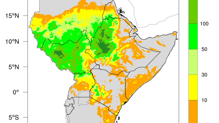
For southern Ethiopia, central to southern Somalia and north-eastern Kenya, ICPAC places the probability of enhanced rainfall at 90 per cent. Seasonal totals could exceed 400 millimetres in parts of central and southern Somalia, central Kenya, the Lake Victoria Basin, Burundi, western Rwanda and western Tanzania.
The rains are expected to begin early to on time across much of Somalia, central and eastern Kenya, southern Ethiopia and most of Tanzania, providing an important window for governments, communities and humanitarian agencies to prepare. However, a wetter season will not necessarily mean a safer season.
A season of opportunity and risk: El Niño
The OND rains are among the most important rainfall periods of the year for much of the Greater Horn.
In parts of Ethiopia, Kenya and Somalia, they can account for up to 70 per cent of annual rainfall, while in parts of Rwanda, Burundi, Tanzania and Uganda they contribute up to 40 per cent.
The rainfall can replenish water sources, improve soil moisture, regenerate rangelands and support crop and livestock production. For communities emerging from dry conditions, the outlook could therefore provide much-needed relief.
At the same time, intense rainfall could increase the risk of flash floods, landslides, waterlogging, crop damage, livestock losses and infrastructure disruption, particularly in exposed settlements, degraded catchments and riverine areas.
This creates a season of competing risks: water shortages may ease in some areas even as flood and landslide hazards increase in others.
The temperature outlook adds another layer. ICPAC forecasts a strong probability of above-normal temperatures across much of the eastern Greater Horn during OND.
Zone I, covering much of Somalia, eastern Ethiopia and extending towards eastern Kenya, carries an 85 per cent probability of above-normal temperatures, while Zone II has a 75 per cent probability.
The combination means preparedness cannot focus on rainfall alone, with an approaching El Niño as water demand, heat exposure and rainfall-related hazards will need to be considered together.
The regional rainfall signal is strongest across the equatorial, eastern and southern parts of the Greater Horn, while conditions vary across the region.
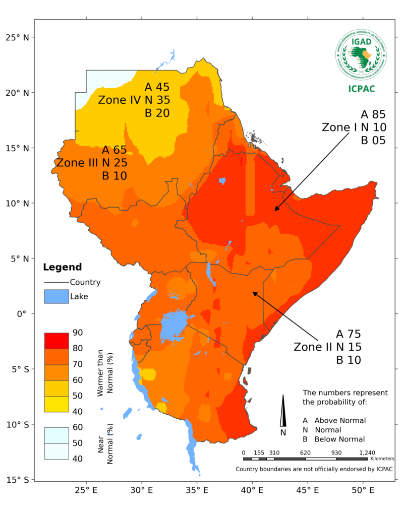
Some northern areas are expected to experience a weaker or opposite rainfall signal, highlighting the need to avoid treating the regional forecast as a uniform prediction for every country or community.
For decision-makers, the message is therefore less about expecting rain everywhere and more about understanding where the strongest signals and risks are likely to occur.
From forecast to early action
For ICPAC Director Dr Abdi Fidar, the value of the forecast will ultimately depend on what happens after it is issued.
“We have the forecast, and it has been provided in good time. What matters now is how we act,” he told delegates, stressing that “early warning must lead to early action.”
He also emphasised the regional nature of climate risks, noting that countries share water resources, ecosystems, markets, transport corridors and livelihoods.
“A climate crisis in one country can therefore have significant consequences for its neighbours and for the wider region,” he said, arguing that cooperation across the Greater Horn is “not simply desirable, but necessary.”
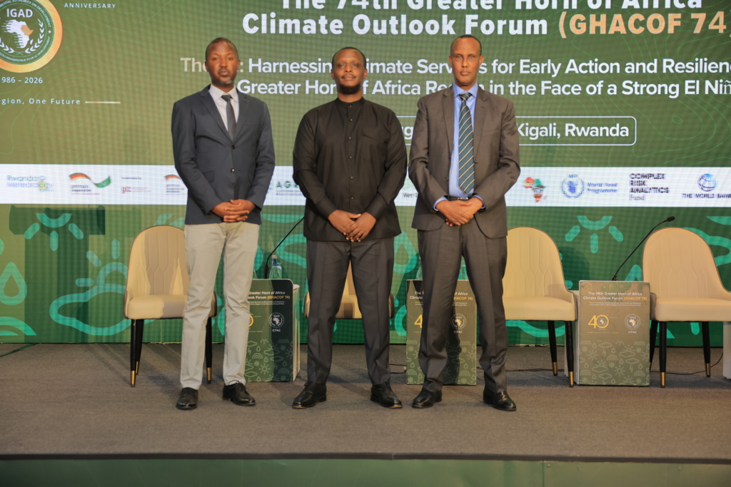
Rwanda’s experience provides a practical illustration of the stakes.
Delivering the guest of honour address, Dr Bernadette Arakwiye said heavy rainfall can rapidly become a multi-sectoral disaster in areas exposed to flooding and landslides.
“My country’s experience shows that heavy rainfall can rapidly become a multi-sectoral disaster, particularly in areas exposed to flooding and landslides,” she said.
She urged countries to use the GHACOF 74 outlook to strengthen preparedness, protect vulnerable communities and critical infrastructure, and ensure that warnings reach people early and in a form they can act upon.
Her call also highlighted the need to place vulnerable groups at the centre of climate services, including women, children, persons with disabilities, older people, smallholder farmers, pastoralists, fishing communities and people living in informal settlements.
For national and local authorities, early action could mean reviewing flood and landslide contingency plans, identifying high-risk settlements, clearing drainage systems, protecting critical infrastructure and pre-positioning emergency supplies.
Agriculture and livestock authorities will need to translate the seasonal outlook into practical advice for farmers and pastoralists as more detailed national forecasts become available. Water authorities will have to balance the opportunity to replenish reservoirs and groundwater against the possibility of sudden inflows and flooding.
Health authorities will also need to monitor risks associated with heavy rainfall, flooding and stagnant water while ensuring continuity of health services in exposed areas.
The emphasis, as Dr Arakwiye put it, must be a shift “from forecasts to decisions” and “from warnings to early action.”
History provides context, not certainty
The current outlook also has historical parallels.
Years such as 1997 and 2023, which experienced comparable El Niño and Indian Ocean Dipole conditions, recorded wetter-than-normal OND seasons across much of the Greater Horn.
ICPAC cautions against treating historical analogues as predictions of what 2026 will bring.
The current seasonal forecast remains the primary reference for decision-making. Seasonal outlooks indicate probabilities over broad areas; they cannot determine exactly when, where or how individual rainfall events, floods or landslides will occur.
That distinction is critical.
A forecast for a wetter-than-normal season does not mean continuous rainfall, nor does it eliminate the possibility of dry spells. Similarly, the seasonal outlook cannot identify the precise location of a flash flood weeks in advance.
That is why ICPAC and national meteorological services will continue to provide weekly, monthly and sub-seasonal updates as the season approaches and unfolds.
The test comes before the rain.
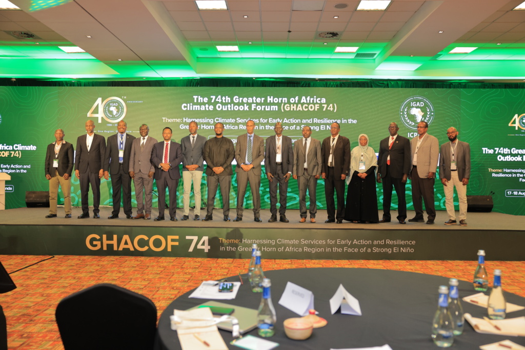
GHACOF 74 brought together representatives from the 10 countries of the Greater Horn, alongside specialists working across agriculture and food security, livestock, water, health, disaster risk management, energy, climate change, conflict and the blue economy.
That broad participation reflects the reality of the coming season.
The OND forecast is not simply a meteorological product. It is simultaneously a food-security signal, a water-management tool, a disaster-risk warning, a public-health consideration and an economic planning instrument. The region now has several weeks to translate the forecast into action as they ensure preparedness, especially with the oncoming El Niño.
The central test of GHACOF 74 will therefore not be how many millimetres of rain eventually fall, but whether the information available today helps governments and communities reduce the damage tomorrow.
The forecast is already on the table. The next step is turning it into action before the rain arrives.